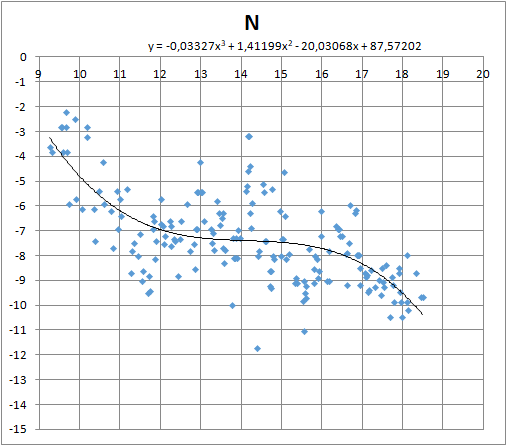
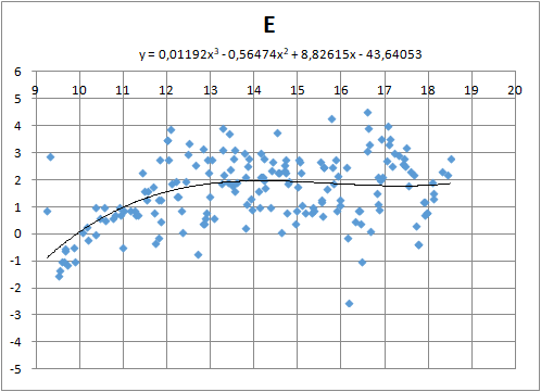
Average wind has been obtained with a third degree polynomial which appeared to be the best approximation for the usual wind variations. Truly amazing are the important wind instantaneous variations around its mean value. On the contrary, mean value changes are very slow.
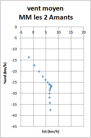
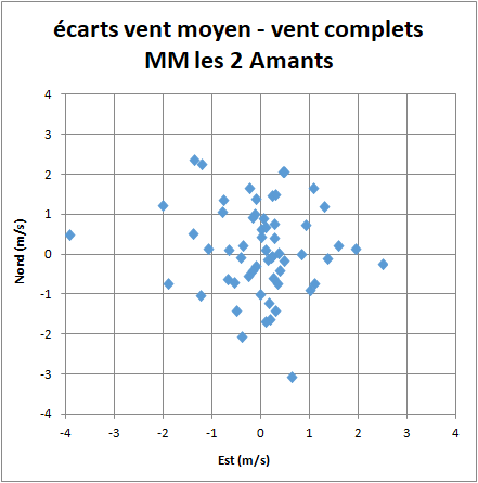
On that chart, the axis are graduated in km/h. There is a dot at each half hour. At the beginning, wind is north, moderate at 15 km/h. It increases until 12:30 at 27 km/h from 340° and stay stable until 16:30 which correspond to the Creuse river. Then the wind is getting stronger up to 37 km/h within two hours. This acceleration in late afternoon is common, but here it is unusually important probably because of the first highs of Massif Central. The variations are the same along and across the tracklog, as can be seen below (in m/s):
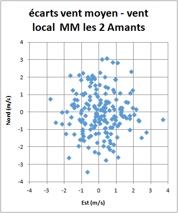
The mean wind is about 8 m/s during the major part of the flight. Deviations around mean wing reach 3 m/s in any direction. Measurement accuracy is not involved since verticalization estimates the local wind with an accuracy better than 0.5 m/s. The conclusion is that thermals are disturbed by horizontal turbulence at any scale. This is not the turbulence encountered at the entrance or the exit of the updraft since the majority of the points are located in the core of the updraft.
It is remarkable that the deviation range is about the same as the vertical speed range of the air in the updraft, which can extend between 0 and 5 m/s. Verticalization measures turbulence in the updrafts only. It would be interesting to measure it during gliding phases. For that, we would need large portions of glides at a constant speed.
Complete thermals
Verticalisation of segments of the tracklog gives an accurate value of the local air speed. But, what happens if we look at a complete thermal? The various circles, seen from above, spread in various directions. It is possible to adjust visually the wind speed to find the best compromise between them.
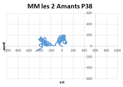
With the same method used for portions of circles, it is also possible to find the best third order polynomial for the mean wind.
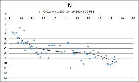
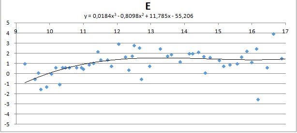
The difference between the two evaluations does not exceed 2 km/h.
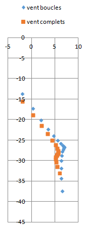
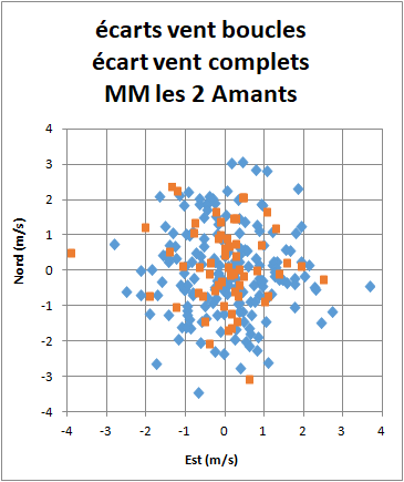
More surprising, the dispersion around the mean value is about the same for complete thermals as for segments.
It is even more visible when overlapping both diagrams.
One could pretend that the strong wind is the reason for the turbulence. The next chart has been created from another flight of Martin Morlet on 3rd July 2014. On that day, Martin performed a nice FAI triangle over Ile-de-France. Wind was south, 5 km/h, near zero compared to that of 1st May 2016. Nevertheless, the turbulence's charts are quite similar.
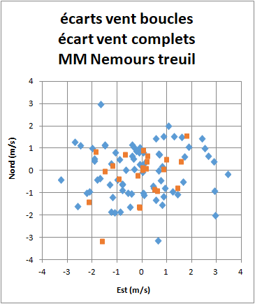
It is clear that thermals move randomly in the convective boundary layer. Their speed can reach 5 to 10 km/h. Some help to progress, others slow down.
Large cross country distances are performed with strong winds. As wind tends to accelerate in late afternoon, landing can be hazardous. However mean wind is changing slowly (except for stormy evolutions). But from a thermal to another, local wind can change substantially. Pilots with a wind calculator must remember to interpret any sharp wind change.
On the other hand, they must be conscious that if they fly in a mean wind of 30 km/h, they could be unluckily exposed at landing to a wind of 35 or even 40 km/h.


